While there’s no replacement for the dependability of a paper map, anyone using a digital supplement will be steadfast in their opinion on which tool prevails. For us, the best tools are the ones that serve multiple purposes and provide a certain level of customization – all without convoluting the experience.
That’s where CalTopo steps in: our preferred tool when it comes to planning at home and navigating in the backcountry. While CalTopo can be used for a variety of activities and objectives, there are five key features that make it our go-to tool for winter backcountry travel (and hut trips, in particular).
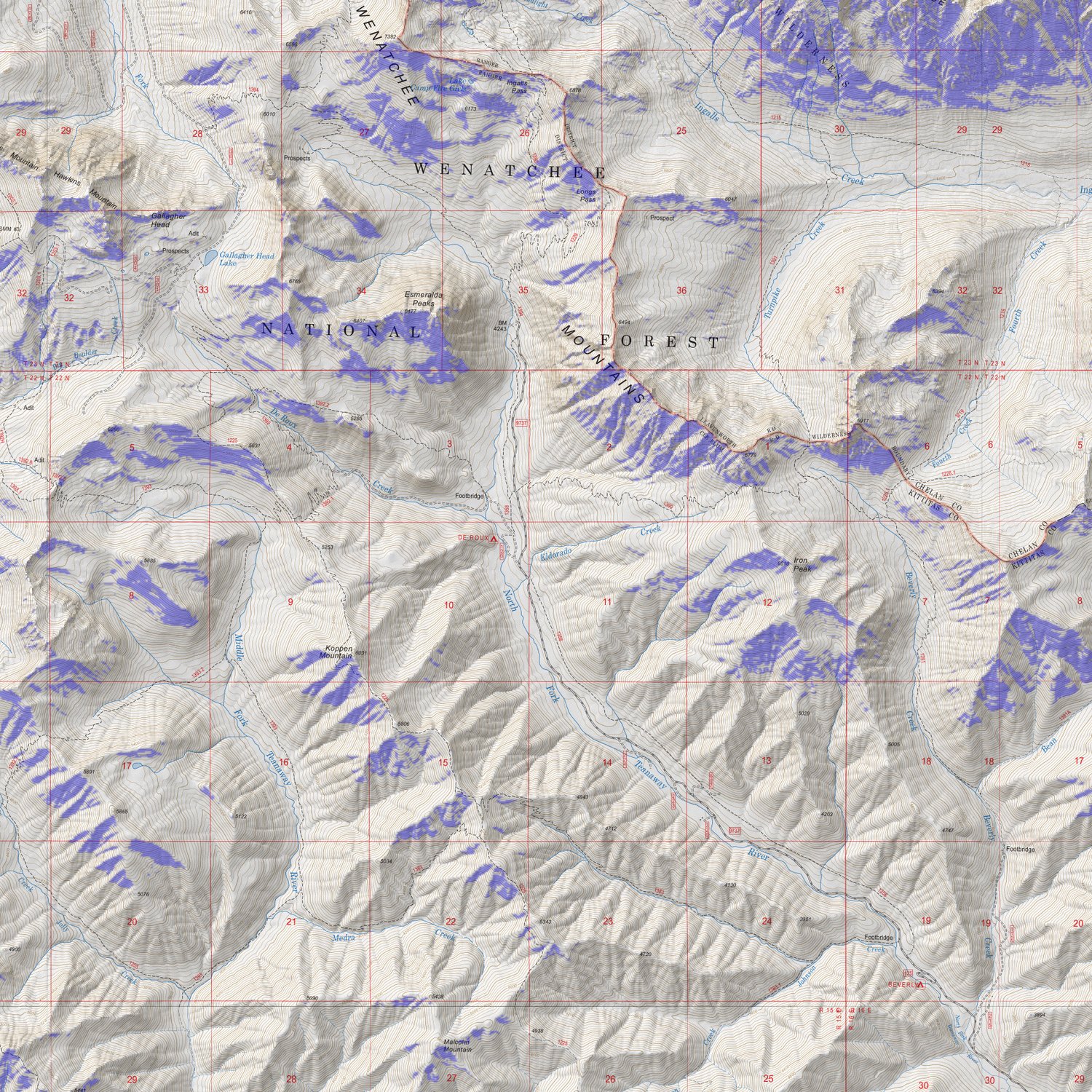
This map identifies slopes between 30º - 45º, on SE/S/SW aspects, within elevations of 5,000' - 10,000'
DEM Shading allows for the creation of base layers or overlays that shade in map areas according to user-specified parameters. For map creators, that could include slope angle, slope aspect, elevation band, and canopy parameters.
This information can be used to identify potential hazard areas or areas of interest. Perhaps there’s a particular avalanche hazard that is worth visualizing for an uptrack. Or, perhaps we’ve identified that we want to avoid the alpine on a storm day and ski less exposed, low-angle terrain in the trees.
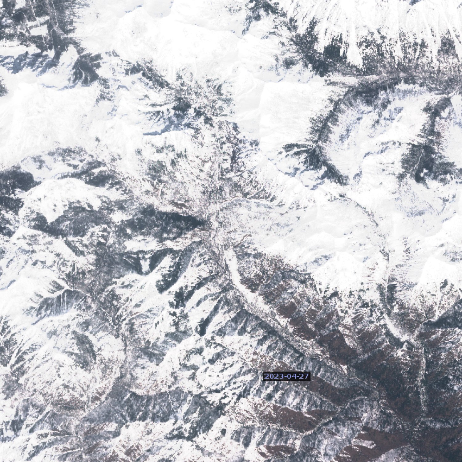
The layer served within CalTopo is updated every 2-7 days, with archival imagery going back as far as 2017
Satellite imagery is an incredibly beneficial tool; but, more times than not, we’re limited to viewing old satellite imagery from an unspecified time of year. That’s where Sentinel satellite imagery comes in! Captured and provided by the European Space Agency’s Sentinel 2 mission, this satellite imagery has more utility than it’s generic counterpart.
Captured weekly, Sentinel 2 imagery offers the right balance between image quality/resolution and frequency. When enabled, this layer can be used to determine snow coverage in relation to route planning no matter what time of year you may be traveling. This becomes particularly useful when it comes to late Fall / early Winter as well as late Spring / early Summer.
The sun exposure layer can provide calculations for the present day (in :30 increments), or by the month (also in :30 increments)
Sun exposure is a mixed bag when it comes to route planning. Perhaps we’re seeking out cold, shaded NE-facing couloirs, or perhaps we’re trying to understand how long a certain slope will be receiving sun in order to time our approach for optimal riding conditions. This layer allows you to overlay estimated sun exposure at a given time for the current day or various months of the year.
This information is best used alongside a mountain weather forecast, as sun exposure is only one aspect affecting the snow surface; wind, ambient temperature, and cloud cover also play a major role.
Leverage this layer when making decisions on start times, turnaround times, firm-snow gear needs, and optimal descent times
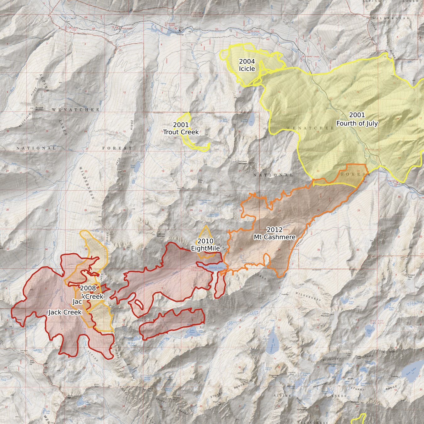
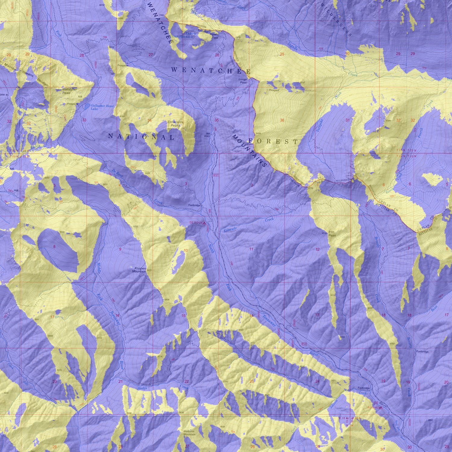
Active fires and fire history are becoming more and more important as we see the frequency of forest fires increasing. While map creators can toggle on information about active fires, specifically viewing the fire history can help identify the condition of the forests you’ll be traveling through.
The Fire History layer also helps demonstrate the prominence of recent burns and the effects that may have on the terrain you’re riding in. In many cases, areas affected by recent burns may have residual debris such as downed trees to consider. In other cases, visitors might seek out these recovering areas for the opportunity to sample the unique visual experience of riding through an old burn area.
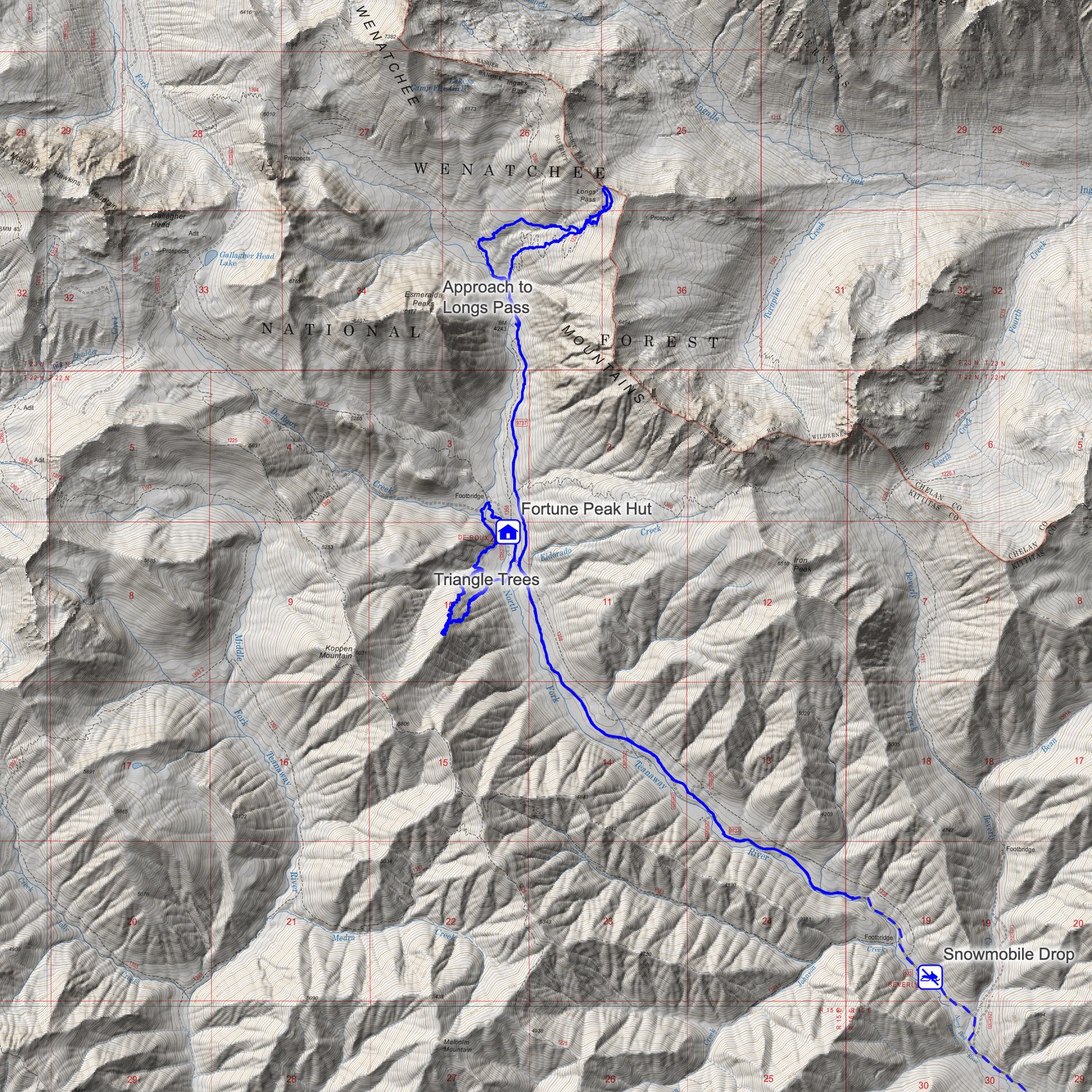
In the majority of mountain environments, access to cell service or internet is a rarity. Offline maps are essential when traveling in these areas, allowing for map creators to specify which layers they’d like to download offline for use in the backcountry.
When it comes to map sharing, a group can operate off of the same map with the ability to individually add waypoints, lines, or polygons throughout the trip. This could be an avalanche observation, a proposed uptrack, or a track from the day’s tour.
When maps are shared as a group, this one map will sync across devices with the latest data assuming an individual’s phones has a brief moment of cellular reception (like on the summit of prominent peaks).
Hut Tripper aims to be the go-to hub for backcountry hut exploration, crowd-sourced beta, and trip planning resources geared toward winter backcountry travelers. We're backcountry enthusiasts, ourselves, combining our love for alpine skiing, the wilderness, and adventure.
We exist to empower new & existing backcountry travelers to explore the mountains in a responsible and informed way, consolidating winter backcountry accommodations as far east as the Rockies and detailing each with an ever-evolving list of hut details and beta.
